|
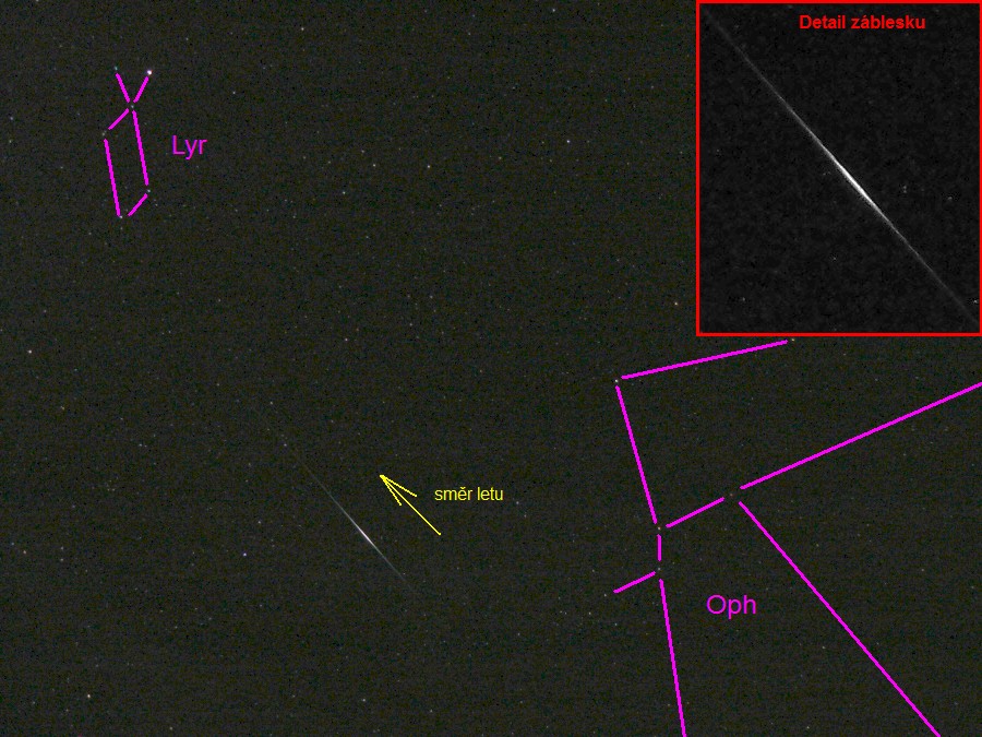
Záblesky družic sítě Iridium
28.5.2017 2:17
Site name: Hnevanice, Czech Republic
Latitude: 49.51400 Longitude: 14.36720 Altitude: 570.0 m
Time Zone: UTC + 2.0 h | Ir# | S | Date | Local Time | Iridium Coordinates | Range (km) | N | Sat Ill | Solar | M | Flare Angle | Mag | Peak Mag | Std Mag | Maximum Flare | Bearing (km) | | Azm | El | RA | Decl | Azm | Elev | Latitude | Longitude | | |
| 20 |
|
2017- 5-28 |
2:17:01.0
| 158
| 47
| 18h38 |
8.2 |
1026.3 |
A |
Lit |
19 |
-16.4 |
F |
2.75 |
1.0
| -8.1 |
0.8 |
49.0190 |
14.1695 |
|
| 20 |
|
2017- 5-28 |
2:17:11.9 |
155 |
50 |
18h41 |
12.0 |
982.4 |
A |
Lit |
19 |
-16.4 |
F |
0.67 |
-3.7 |
-8.2 |
-3.8 |
49.5473 |
14.1930 |
12.7 W |
| 20 |
|
2017- 5-28 |
2:17:22.0 |
152 |
54 |
18h45 |
15.8 |
945.6 |
A |
Lit |
19 |
-16.4 |
F |
2.84 |
0.9 |
-8.3 |
0.9 |
50.0388 |
14.2149 |
|
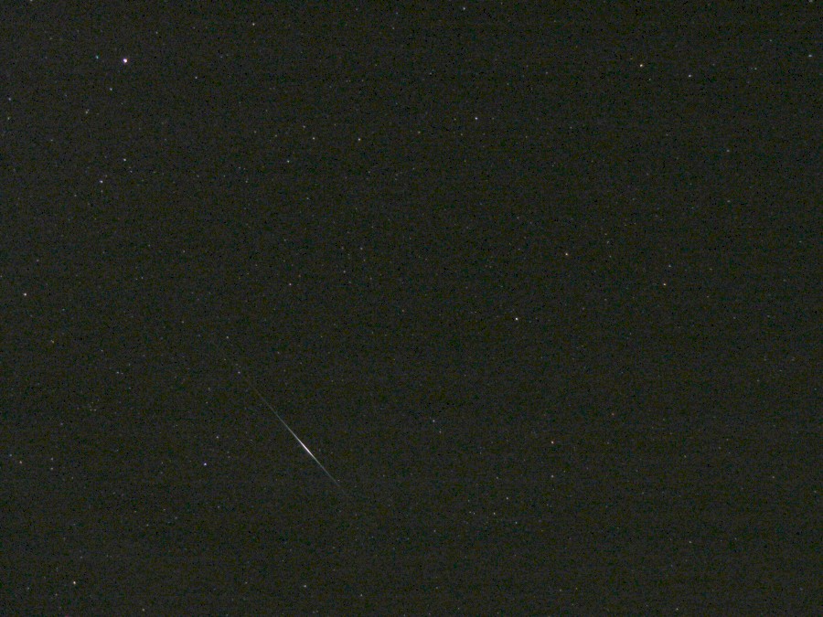
Popis fotografie
(Neupravená fotka je tady)
|